A vast majority of the international scientific community is in agreement that humans are to blame for the rise in greenhouse gases that are warming our planet. The possibility of catastrophic climate disruption due to rising sea levels, more massive rainstorms, droughts, and extreme disasters are no longer a worry for the future, but are instead taking place in real-time.
Climate change is making bad weather increasingly devastating, which could lead to apocalyptic conditions such as food and water shortages that affect millions of people worldwide. We have to act fast to cut carbon emissions dramatically; our growing access to efficient technologies, such as drones, might make this impossible feat a bit easier.

Mapping and Rebuilding Conservation Land
Unmanned aerial vehicles, commonly known as drones, are no longer limited to military use or the production of fun YouTube videos. Their affordability, efficiency and user-friendly features are opening the doors to dynamic opportunities in the field of science. Thanks to their aerial imagery sensor and monitoring capabilities, drones are being used to gather images, video, and data to piece together the effects of climate change. They don’t only allow us to understand how the natural world is changing, but also assist in combating deforestation, protecting wildlife populations and advancing sustainable agriculture.

Drones have helped scientists make landmark progress in mapping and rebuilding conservation land around the world. Drones not only monitor large areas with less impact and ease than humans, but they also reach inaccessible areas to address complex conservation issues.
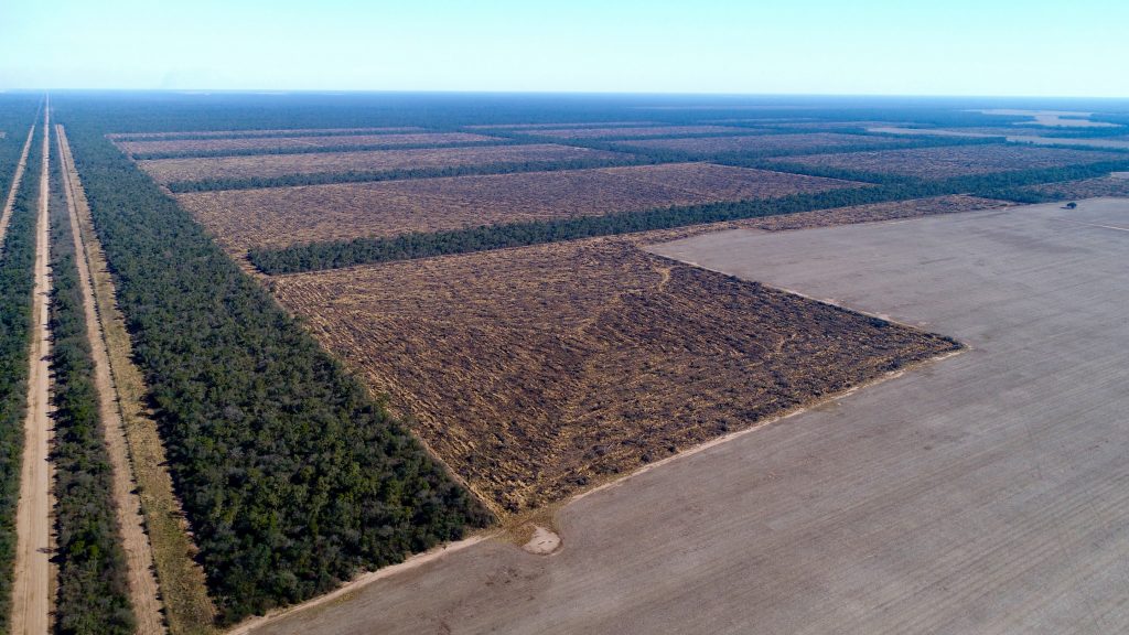
They can carry data instruments including wind gauges, thermometers, and pressure sensors to understand how environments, such as coral reef populations, are reacting to climate change and pollution. Their cameras capture high-resolution images and videos that can be used to create 3D maps and identify erosion and deforestation in areas that would have otherwise been overlooked.

When a destroyed environment is detected, drones are a cheap and efficient method to plant seeds, deliver water and spray herbicides to regrow whole habitats. A single drone has the potential to plant 100,000 trees in a single day.
Wildlife Protection
Conservationists are also embracing drone technology to monitor and protect species. WWF Brazil and Mamiraua Institute teamed up to protect the dolphin population in the Amazon who are categorized as data-deficient.

These drones collect aerial images and data on the dolphin population numbers, mortality and reproduction rates. Scientists are using this hard data to influence policy in the Amazon and get dolphins added to the vulnerable and endangered species lists to protect them from the threats of fishermen and habitat destruction. Conservationists in other parts of the world are fitting drones with thermal imaging cameras to catch illegal poachers and stop them before they act.

Disaster Relief and Prevention
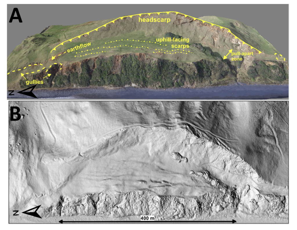
Disasters are inevitable, but now with the help of drones, we can identify them before they happen and respond more quickly and efficiently once they do occur. According to Wired, Drones have been used in China to identify landslide risks and alert authorities of the coordinates. They can even identify flood-prone areas and monitor volcanoes. Once a disaster does strike, the drones are also an incredible tool for gathering data on affected areas that vehicles cannot reach. They build up a picture of the devastation which can help rescue teams direct their resources to mitigate damage and save lives. The 3D maps created from the images and videos also guide reconstruction plans post-disaster.

Healthier Environment with Sustainable Agriculture
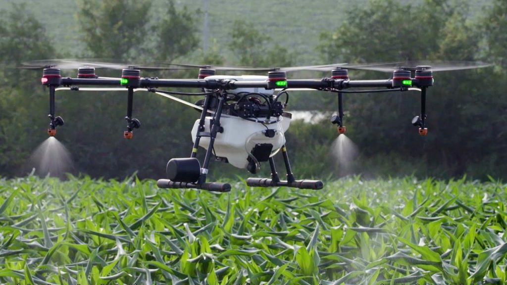
Finally, farmers are finding drones to be an invaluable tool in almost every aspect of the sustainable agriculture business. They are replacing gas-guzzling machinery and proving to be much more precise in the distribution of fertilizers, cutting input use up to 20%. This is not only positive for the farmer’s wallet, but it is also protecting the environment from pollution runoff. Drones have proven helpful in monitoring livestock, water levels and crop health with their high-resolution images.
Farmers can now use drones’ fast and flexible aerial surveying to plan for future expansions and upgrades that help increase their yield. This type of monitoring can actually help people turn it into a

Environmentalists and scientists now have an incredible new tool to preserve the environment in a smart, efficient and environmentally-friendly manner. Not only can we reduce waste and curb our emissions, but we can also begin undoing the decades of environmental damage.
The future Environment
In the future drones will have
Very soon drones will transport almost everything we ever need. From transporting goods for every day up to transporting medical supplies in highly remote areas. All of that on a much lower impact on the environment, cheaper and more sustainable way. The fossil fuel era is coming to an end, and all of that because of our desire for new possibilities.
Humans have always been aiming high, that is why they chose the sky.

