
- Why use disaster response drones?
- Ways in which drones help in dealing with disasters
- The difference between disaster response and commercial drones
A very promising division in the drone industry is disaster response drones. These drones can greatly improve the efficiency of the response time and quality of almost all of the catastrophic events. Given that the most crucial time for the response, in any event, is the first 72 hours, drones are extremely helpful in many ways.
With the newest technological achievements in this industry like high-speed capabilities, camera possibilities, and the power to transport heavy loads, disaster response drones can be extremely helpful in many ways.
In critical times, Drones can map the area, search for survivors, capture imagery for news coverage, and much more. These drones also come in handy when hardly accessible places need to be scanned. The drones can accomplish this in a matter of minutes, instead of hours.
Most Effective Ways of Disaster Response Drones
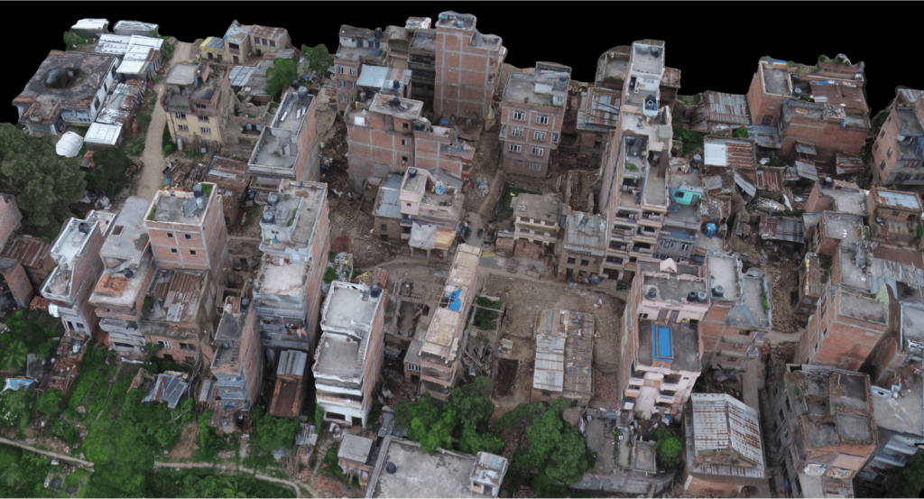
Mapping
Drones are superior when it comes to mapping, compared to more traditional and outdated methods. They are quick at producing photos and provide high-resolution 3D models, unlike low-resolution satellite images.
This method is greatly responsible for fast recovery following the 2015 Nepal earthquake. The company Pix4D in collaboration with Kathmandu University organized training for students on how to use drones and image processing Softwares for a wide range and humanitarian development proposes. With this skill, the local community is able to create 3d models of the existing conditions that will help in the future reconstruction of the devastated buildings. A very similar method to this was used for the reconstruction of the post-fire conditions of the Notre Dame in Paris.
Hazardous Chemical Spills
A chain of different events can sometimes cause a disaster better known as CBRNE (chemical, biological, radiological, nuclear, or explosive events). In disaster situations like this, direct human intervention is almost impossible.
Remote actions with drones prove to be the right way to place the situation under control, without exposing human life to unnecessary conditions. Drones are equipped with different tools in order to analyze the place, detect the amount of radiation if a nuclear plant is damaged, or use infrared or ultraviolet cameras to detect hazardous spills invisible for the naked eye.
In 2011 disaster response drones helped in dealing with the dangers of the damaged Fukushima Daiichi nuclear plant in Japan. During this process, many stakeholders became invested in different software or hardware solutions that can be used in dealing with CBRNE events. One of the outcomes is the REISER drone, developed by Createc.
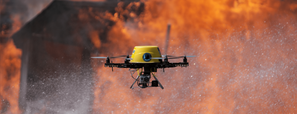
Wildfire Extiguishers
With continuous global warming, we are witnessing more and more wildfires happening. Often, those fires take the lives of many brave firemen. Drones minimize all those risks and help by directly spraying water over the burning area, but they can contribute in many other ways too.
The Great Plains region is another area where drones fight fires, but this time, using fire. The region is famous for its vast grasslands which are slowly disappearing, due to the easy spread of fire through tree elimination. According to Dirac Twidwell, a range ecologist in the University of Nebraska, drones can be used to have a higher impact on burning only selected targets. With this method, he believes that only specific areas can be burnt and spot the spread of potential future fires.
Emergency Infrastructure and Supply Delivery
After a disaster, normal roads and transport lines are compromised. This is a dangerous situation for the people trapped inside the area. Drones help by delivering the essential supplies or infrastructure needed. This idea of drones transporting medical supplies was first tested in Rwanda, where medical supplies were delivered to remote areas.
Another promising feature of Drones in disaster response is the capability to establish temporary wifi which can greatly improve communication. The topic of airborne internet connection was utilized by the US military in order to send larger amounts of data from one aircraft to another or to ground stations. Two other pioneers in the field of airborne internet are Google Project Loon and Mark Zuckerberg’s internet.org. All of these projects are aiming to increase hyperconnectivity while aiming to provide internet in remote locations.

How different are the disaster response drones from regular ones?
Disaster response drones are the same as the commercial ones that many drone enthusiasts fly on a daily basis. For example, a DJI Mavic Pro drone can be just as good for disaster response as for photography. The differences, however, lie in the kit that the pilot chooses. Drones that have easily replaceable parts are usually better for this purpose.
Countries around the world continue to acknowledge the benefits of dealing with disasters using drones. It is going to take some time for the full utilization of drones in these scenarios, how long until then is still unknown. One thing is certain, it will be necessary to implement drones in recovering from disasters in the future.
Check out the role of drones in the current COVID-19 crisis here.